Skip to main content
Log in
Search form
Search
Victoria and Region Community Green Map
a celebration of living sustainably in the Victoria Region of British Columbia
Main menu
Home
About
Map
Central Saanich
Colwood
Esquimalt
Highlands
Juan de Fuca
Langford
Metchosin
North Saanich
Oak Bay
Saanich
Salt Spring Island
Sidney
Sooke
Southern Gulf Islands
University of Victoria
Victoria
Gonzales Neighbourhood
North Park Neighbourhood
Oaklands Neighbourhood
View Royal
Icons
Featured Sites
Stories
Contribute
First Nations
Error message
The file could not be created.
The file could not be created.
SṈIDȻEȽ (Gowlland-Tod Provincial Park)
Location type:
Park / Recreation Area
Clawthorpe Park
Location type:
Park / Recreation Area
Oswald Park
Location type:
Park / Recreation Area
Hillside Park
Location type:
Park / Recreation Area
Oaklands Green
Location type:
Park / Recreation Area
Mt Stephen Park
Location type:
Park / Recreation Area
Wesley Park
Location type:
Park / Recreation Area
David Spencer Park
Location type:
Park / Recreation Area
Oaklands Park
Location type:
Park / Recreation Area
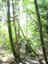
Geog 391 Cedar Hill Recreation
Location type:
Park / Recreation Area
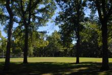
UVic Quadrangle (the Quad)
Location type:
Park / Recreation Area
Filter by location type
Location type
Culture and society
Cultural character
Art spot
Community Centre
Cultural Performance
First Nations site
Historical Feature
Memorial / Site of Conscience
Museum
Public Works, Landmarks
Cemetery
Government Office
Hospital
Landfill
Lighthouse
Prison / Detention Centre
Solid Waste Transfer Station
Waste Water Treatment Plant
Eco-Information
Environmental Education
Green Maps Available
Public Library
Justice & Activism
Eco Club / Organization
Eco Expert
Significant Organization / Agency
Social Service
Volunteer Opportunity
Nature
Fauna
Amphibian Habitat
Aquatic Habitat
Coastal Habitat
Duck Pond
Migration Zone
Salmon spawning
Unprotected Significant Habitat
Wildlife Centre
Flora
Camas Meadow
Culturally Modified Tree
Food Gathering Site
Garry Oak
Native Forest / Plant Restoration
Protected Natural Area
Sea Vegetables
Special Tree
Outdoor activities
Camping
Canoe/kayak site
Dog Run
Eco-tour / Nature Walk
Park / Recreation Area
Public Space / Square
Sailing / Row Boat Launch
Scenic Vista
Skateboard Site
Sport Site
Star Gazing
Sunrise / Sunset
Swimming
Land and water
Cleaned-up / Restored Site
Drinking Water Source
Geological Feature
Natural Corridor / Greenway
Waterfront / riverside park
Wetlands
Sustainable living
Food systems
Community Garden
Eco-agriculture / permaculture
Farmers / local market
Food Bank
Green economy
Ecotourism Resource
Fair trade
Recycling
Reuse
Social Enterprise
Technology & Design
Composting
Geothermal / Ground Heat Site
Green Building
Green Roof
Greenhouse Gas Reduction Resource
Self-Built House
Solar Energy Site
Water Recycling
Mobility
Alternative Fuel / Vehicles
Bicycle Parking
Bicycle Path
Bicycle Site
Light Rail / Bus Rapid Transit
Park and Ride Facility
Public / Mass Transportation
Water Transport
Newcomers
Getting started
Language
Settlement
Getting settled
Support Services
Finding a job
Education / Schools
Banking / Finances
Child care
Getting connected
Culture
Faith / Religion
Seniors
Volunteer
Recreation