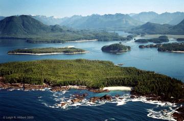
In May 1790 Spanish explorer Manuel Quimper arrived in Clayoquot Sound on his expedition to explore and chart the west coast of Vancouver Island and the Strait of Juan de Fuca. Quimper, his first pilot López de Haro and their crew left Nootka Sound on May 31 in the ship the Princesa Real and arrived the next day, June 1, at Clayoquot Sound at 8pm. They visited the village of Wickaninnish, chief of what is now part of the Tla-o-qui-aht First Nation. It so happened that Chief Maquinna, the Mowachaht chief whose summer village of Yuquot was at Nootka Sound, was also present at Clayoquot at the time. Both chiefs and their peoples were familiar with the Spanish explorers and it seems that relations were for the most part friendly and relatively respectful at the time. The Spanish officers gave gifts of copper and scarlet cloth to both men to gain their favour and maintain good relations. When Quimper told them that he planned to explore the coast and sail into the Strait of Juan de Fuca, the chiefs warned him that the local people further south could be “treacherous.” They also learned from Wickaninnish that the port had recently been visited by seven fur-trading ships, including an American ship. This was significant because the Spanish were trying to maintain sovereignty over the coast and disliked other nations trading in the area.
Quimper spent the next few days charting the many channels of Clayoquot Sound. In a letter to the viceroy in New Spain (present-day Mexico) about the sound, Quimper wrote "procediendo inmediatamente a su reconocimiento, del cual resultó hallar con no convenir el plano que saqué de Nuca con él" ("proceeding immediately to the exploration of the port resulted in the discovery that the charts we took from Nootka [of Clayoquot Sound] did not match up with what we found there"). Quimper worked to make more accurate charts of the area. On June 10 the Princesa Real left Clayoquot and headed south towards the entrance to the Strait of Juan de Fuca. They continued to enter bays and inlets along the coast, including the puerto de San Juan, the inlet in which Port Renfrew is located, as well as Sombrio and Jordan rivers as they reached the mouth of the strait.
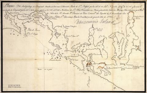
This chart of Clayoquot Sound was made by Quimper's superior officer Francisco de Eliza in 1791. It is likely that he based the chart off of the ones Quimper had made the previous year.
Read the next part of the story: Quimper at Sooke Harbour
Read more background on the expedition: Quimper’s Expedition of the Strait of Juan de Fuca
Sources:
Dewhirst, John, "Tla-o-qui-aht (Clayoquot)" The Canadian Encyclopedia, 13 July 2009, http://www.thecanadianencyclopedia.ca/en/article/clayoquot-tla-o-qui-aht/
Layland, Michael. A Perfect Eden: Encounters by Early Explorers of Vancouver Island. Touchwood Editions, 2016, pp 40-41
Rodríguez-Sala Muro, María Luisa. "Dos expediciones de altura al Pacífico Septentrional (1788-1790) y sus protagonistas: Manuel Quimper y Gonzalo López de Haro." Revista de Historia Naval. 2011, pp 60.


