
VENUS Buoy Profiling System
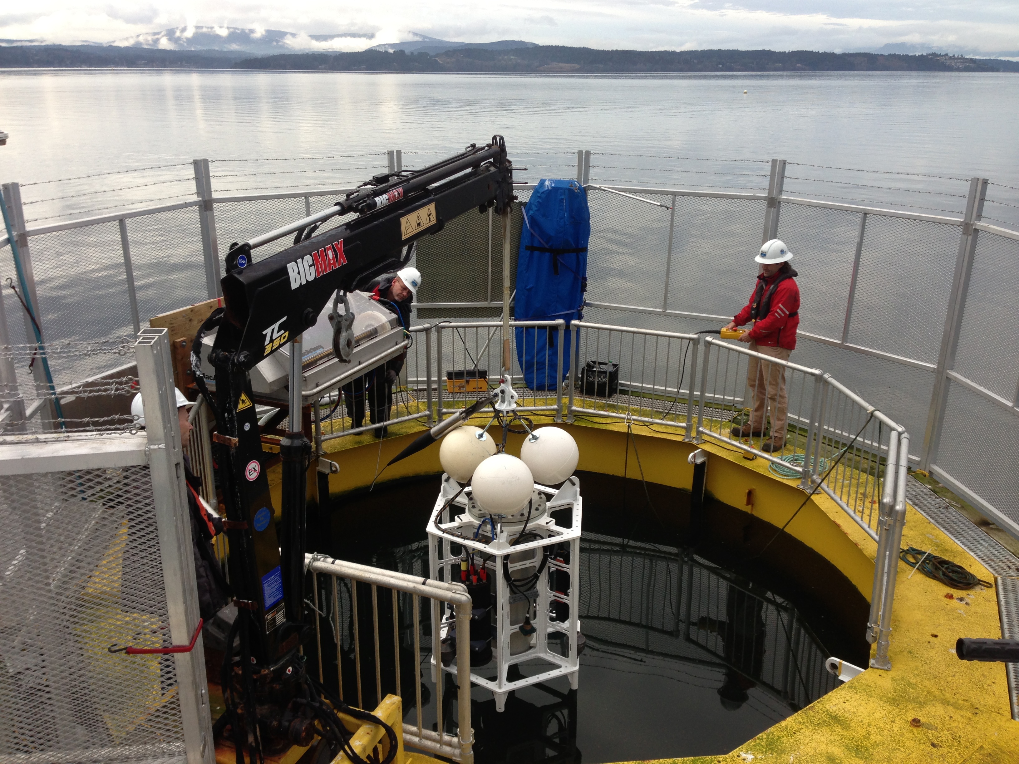
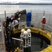
The VENUS Buoy Profiling System (BPS) is part of the VENUS Phase II - Geospatial Expansion development in the VENUS Observatory, a cabled undersea laboratory for ocean researchers and explorers. The Buoy Profiling System is in its testing stages at the Ocean Technology Test Bed (OTTB) before deployment in its permanent location in the central Saanich Inlet, west of Coles Bay. The BPS consists of a meteorological station, surface winch, and control system connected to the VENUS Node in Patricia Bay. The BPS will allow scientists to study marine life and processes in the water column, rather than on the seafloor.
Ocean Networks Canada (ONC) is a not-for-profit at the University of Victoria that governs both the VENUS and NEPTUNE ocean observatory networks off the coast of Vancouver Island. The observatories gather real-time data, signals, and images that are available online for the public, students, and researchers to explore.
Take a trip to the bottom of the ocean! 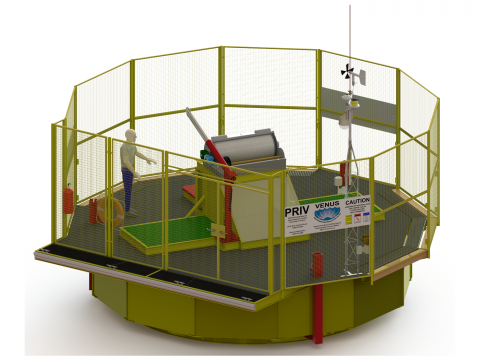 The public can explore the diverse marine environments off the coast of Vancouver Island by viewing live and recorded video feeds, an endless array of vibrant photos, and direct access to real-time scientific data on the Ocean Networks Canada website. Ocean Networks Canada is dedicated to supporting ocean discovery and technological innovation and is a world-leading scientific research facility. The website, where all of the data is contained, is open to the public 24/7!
Related sites on the CRD Green Map:
- VENUS Saanich Inlet Node
- VENUS Strait of Georgia Central Node
- VENUS Instrument Platform (VIP), Saanich Inlet
- VENUS Camera Platform, Saanich Inlet
- VENUS Saanich Shore Station
- VENUS Forensics Experiment
- VENUS Instrument Platform (VIP), Strait of Georgia
Related Links
- The societal benefits of Oceans Network Canada (ONC) Observatory
- Why Venus?
- Map of VENUS Observatory
- NEPTUNE Canada - for even more great data, videos, and research in the deep sea, extending beyond the CRD
Please note that the location for the VENUS Buoy Profiling System is approximate.
Photo and video credit: Ocean Networks Canada
Region:
Location type:
Organization name
Address:
Website:
Email:
Phone number:
Related videos, images and documents


- Log in to post comments
- 3686 reads